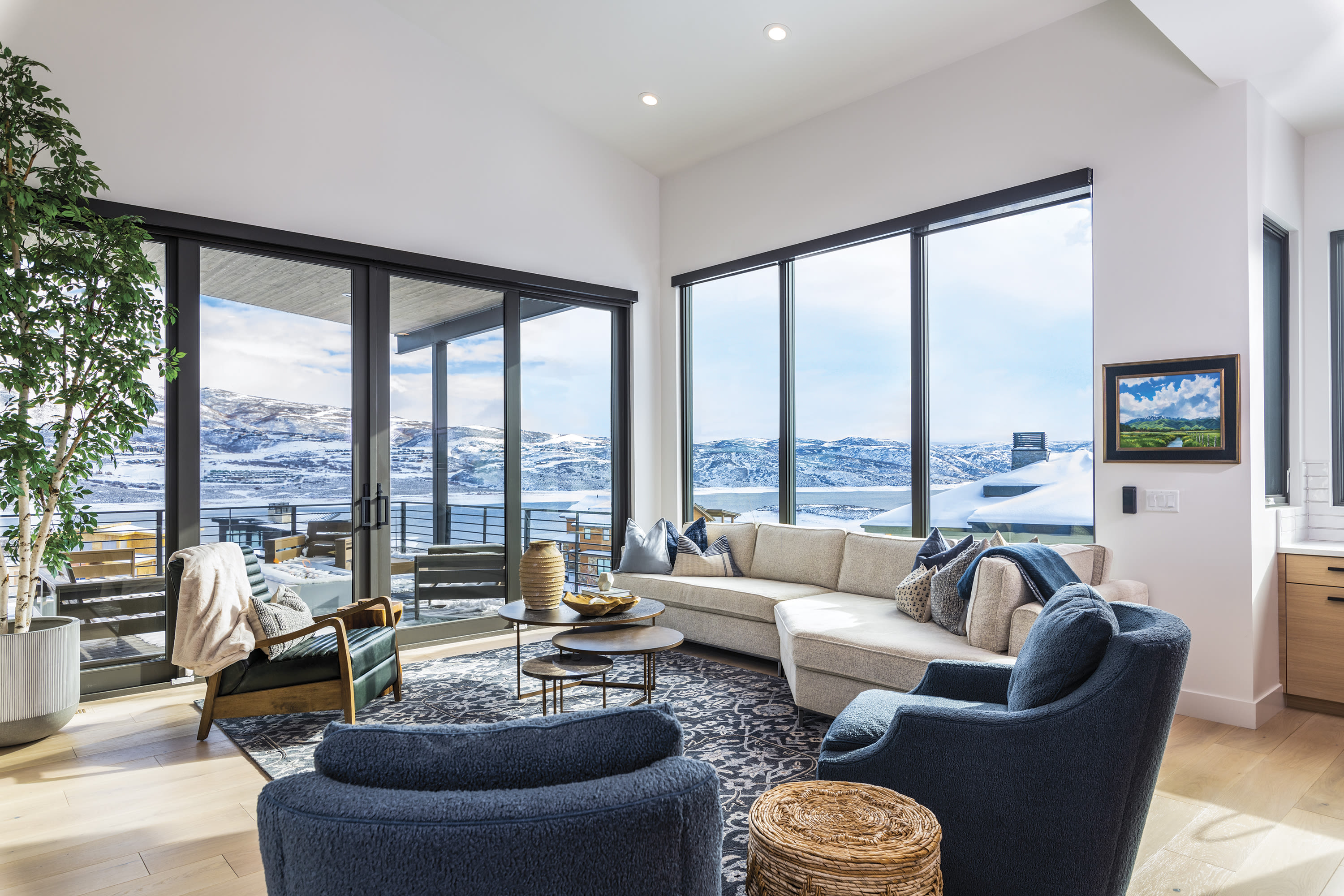
An Insider Guide to Mountain Biking Park City
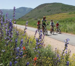
A trio of riders sample some Park City dirt on the Lost Prospector Loop.
Image: Mike Tittle
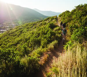
In terms of quality, quantity, and variety, Park City mountain biking is bomber, sick, tight—in other words, the best you’ll find just about anywhere. The off-road opportunities here include family-friendly spins, get-your-groove-on pump tracks, breathtakingly scenic cross-country routes, buff flow trails, white-knuckle downhill circuits, and freeride parks teeming with adolescent beginners and seasoned pros alike. In case you haven’t heard, Park City was the world’s first—and remains the only—Gold-level Ride Center, as determined by the International Mountain Biking Association (IMBA). That means not only is the mountain biking here superb, but the out-of-saddle opportunities—dining, nightlife, other outdoor activities—are also plentiful and diverse. Following is an insider’s glimpse at the goods: an orientation to Park City’s singletrack districts; some of our favorite rides ranked appropriately as Easy Rider (beginner), Diggin’ the Dirt (intermediate), and White Knuckler (advanced); trailside good eats; and tips for keeping your wheels spinning all summer long. (Special thanks to the Mountain Trails Foundation for sharing its maps.)
Town Trails & the Resorts
Wherever you stand within Park City’s 17.5 square miles, it takes just a few dozen pedal strokes to reach a trail. From the every-rider’s Rail Trail to fresh freeride additions like Deer Valley’s Payroll, these trails represent the backbone of the Park’s in-town off-road riding.
The Historic Union Pacific Rail Trail
Image: Mike Tittle
Town Trails
Historic Union Pacific Rail Trail
Get there The Prospector trailhead is located behind the Park City Plaza just off of Bonanza Drive.
Distance 28 miles, one way
Difficulty Easy Rider
Actually a state park, the Rail Trail follows an old railroad line east from Park City through Wanship and Coalville to the Echo Reservoir. Partly paved, partly cinder, it was Utah’s first nonmotorized rail trail. Even the youngest riders can navigate the Rail Trail, which also provides car-free access to a number of secondary trails and parks. Expect to see plenty of strollers, joggers, and dogs along the way as you pass by wetlands, sagebrush, and Gambel oak.
McCloud Creek Trail
Get there Find parking either just across SR 224 from McPolin Farm, at Willow Creek Park (at the intersection of Split Rail Lane and Old Ranch Road), or most conveniently at the Basin Recreation Fieldhouse (1388 New Main St).
Distance 4 miles
Difficulty Easy Rider
Traveling north from town to Kimball Junction, the McCloud Creek Trail passes through wooded areas, around a farm, over bridges, and through the Swaner Nature Preserve. Be sure to make time for a spin through Ike’s Pump Track (a small dirt track filled with easily navigable bumps, jumps, and berms) at Willow Creek Park. Dogs are welcome on this trail, but please keep them leashed as the trail passes by a farm with free-range animals.
Lost Prospector
Get there Access from the Rail Trail Prospector trailhead parking lot on Bonanza Drive
Distance 7.8 miles
Difficulty Easy Rider/Diggin’ the Dirt
Appropriate for both physically fit advanced beginners and accomplished mountain bikers looking for a quick yet effective workout. Head right (west) out of the parking lot. Follow the Rail Trail for a mile and a half to the Deer Valley Drive roundabout. Circle the roundabout and head back downhill (north) on Deer Valley Drive. Take a right onto Aerie Drive and watch for the Lost Prospector trail marker on the left. Gambel oaks and sage along the even singletrack trail here soon give way to quaking aspens and tall wildflowers. Get your kicks on a few mellow, wide switchbacks as you make the descent back to the Rail Trail. Head right once you touch back down on the Rail Trail; the Prospector trailhead where you began is a mile down on your right.
Old Town Loop
Get there Located off of Lowell Avenue in Old Town Park City
Distance 7 miles
Difficulty White Knuckler
This fun and challenging loop’s spitting-distance location from Main Street is why many regard Park City as a mountain biking mecca. Head up (south) on Lowell Avenue from Park City Mountain Resort’s base area to the Sweeney’s Switchbacks trail. The short double-track quickly turns into a shady singletrack characterized by tight turns, rocks, and tree roots. Enjoy views of Old Town and up-close encounters with Aerial Tramway towers from Park City’s silver-mining era. Once you reach the top of the Town Lift, stay left onto Drift (gravel road) up to Johns Trail. Turn in here and prepare yourself for an exciting descent though tight turns and aspen groves. Cross King Road and continue right briefly on a double-track and look for the Grave Digger trail sign. Grave Digger’s constant pitch takes you over a few rolling hills to another gravel singletrack that eventually turns into the paved Daly Avenue. Let gravity be your guide as you cruise down Daly to Main Street and back to PCMR.
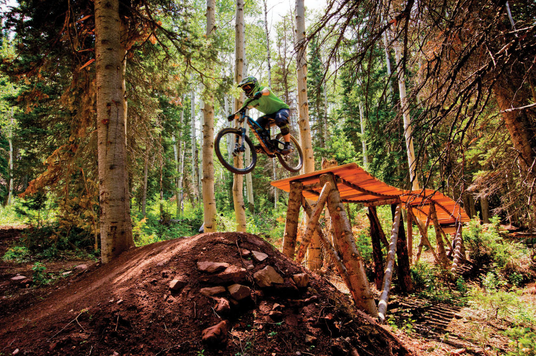
PCMR's Pinecone Trail
Image: Ross Downard
Park City Mountain Resort
The lines between town and trail are blurred at the town’s namesake resort (435.649.8111,parkcitymountain.com). Use your own steam to climb trails like Jenni’s or Armstrong from the base, or hang your ride on the Crescent or Town Lift chairs for direct access to the Mid Mountain Trail. (PCMR’s PayDay lift is used only to access the Alpine Slide, hiking, and scenic rides.) Don’t forget to keep your eyes peeled: numerous mining-era structures dot the landscape throughout PCMR’s broad acreage.
Silver Spur
Get there Located near the base of the Crescent chairlift
Distance Half mile
Difficulty Easy Rider
If you’re looking for a place at Park City Mountain Resort’s base area to test out your off-road skills—or give your kids a taste for riding on dirt—this half-mile piece of relatively flat singletrack is the place.
Jenni’s Trail
Get there Begins at the resort base area; ends at the top of the PayDay chairlift
Distance 5 miles (the lower mile is open to uphill traffic only)
Difficulty Diggin’ the Dirt
This wide singletrack trail, meandering through meadows and aspen groves back and forth under the PayDay chairlift, provides the most direct pedal access to upper mountain trails for those who choose not to ride the Crescent chairlift. A fun intermediate 12-ish-mile loop is Jenni’s to the Crescent Mine Grade (or CMG as it is referred to by locals) and north (right) along the Mid Mountain Trail for a little over a mile to Spiro, and then back to PCMR’s base area.
Mojave/Tommy’s Two Step
Get there Access from the top of the Crescent chairlift
Distance Both about a mile
Difficulty Diggin’ the Dirt
Mojave and Tommy’s were new last season and take intermediate riders from the top of the Crescent chair to the Mid Mountain Trail. Mojave was built with rollers and twists along a fun downhill but with somewhat limited sightlines, so keep your head up for other bikers and hikers. Tommy’s broad, banked turns provide a very manageable uphill climb. From Mid Mountain there are many ways down the lower mountain; an intermediate-to-advanced descent is Mojave to Mid Mountain to CMG.
Pinecone
Get there Take Crescent lift and head north onto the MidMountain Trail to Pinecone.
Distance 8.5 miles, one-way
Difficulty Diggin’ the Dirt
Pinecone is technically easy but requires serious endurance to grind up to the famed Wasatch Crest Trail. Pack plenty of water and energy-rich food. Take the Crescent lift from PCMR’s base and head north on Mid Mountain. Pinecone is two miles from the intersection of the Mid Mountain and Spiro Trails. It’s another four miles along well-packed singletrack through shady aspen and pine stands to the Crest. (You’ll know you’re close to the Crest when the trail gets wicked steep.) Enjoy the fruits of your labor by taking a minute to soak in the views and have a bite to eat at the top.
Armstrong/Spiro
Get there Park at the Silver Star development (1825 Three Kings Dr) or in PCMR’s parking lot adjacent to the First Time chairlift.
Distance 7-mile loop
Difficulty Diggin’ the Dirt
A manageable uphill-traffic-only climb along Armstrong followed by a “like buttah’” descent on Spiro makes this one of the Park’s most popular loops. Begin by heading right onto Armstrong at the trailhead, located just off of the patio at the Silver Star Café, and climb four miles and 1,600 feet to Mid Mountain. Take a left here and ride for just over two miles to Spiro. Enjoy the fruits of your sweat equity on the flowy, aspen-lined descent back to the café. (Be sure to keep an eye out for uphill riders and hikers.)
Deer Valley's Deer Camp Trail
Image: Eric Schramm
Deer Valley Resort
DV (435.649.1000, deervalley.com) first started turning the bull wheels on its lifts for mountain bikers in the summer of 1992, making it one of the first ski resorts in North America to offer year-round lift service. The resort now operates the Silver Lake Express at the Snow Park base, Sterling Express (downhill riding only off this lift) from Silver Lake, and Ruby Express in Empire Canyon for mountain bikers, hikers, and scenic rides, June through Labor Day. Rentals are available at the base of all three lifts, and Deer Valley’s Mountain Bike School offers all levels of instruction.
McHenry's Practice Loops
Get there Near the base of the Homestake chairlift at Silver Lake Village
Distance 1.5 miles
Difficulty Easy Rider
Get used to riding on dirt and practice weight-transfer skills on this short, wide trail following an almost flat grade. It’s ideal for older-grade schoolkids and adults longing for a taste of singletrack.
Tour de Homes
Get there Access off the top of Silver Lake Express
Distance 2.5 miles
Difficulty Diggin’ the Dirt
This wide, scenic trail mixes single- and doubletrack, winding its way past enormous homes peppered throughout the hillsides between Deer Valley’s Silver Lake Village and Snow Park Lodge. This is the least difficult trail down to the Snow Park base area.
Deer Camp
Get there Access from the top of Sterling Express chairlift
Distance 3-plus miles
Difficulty Diggin’ the Dirt
One of Deer Valley’s most scenic trails winds its way off of Bald Mountain through waist-deep meadows of wildflowers and past stunning views of Mount Timpanogos and beyond. Keep an eye out for foot traffic coming your way on the descent, as this trail is popular with hikers, too.
Corvair (with Payroll option)
Get there Top of Ruby Express lift
Distance 2.5 miles
Difficulty Diggin’ the Dirt/White Knuckler
After exiting the lift, follow Boulder to Moose Bones. Ride the paved Guardsman Pass road briefly to the well-marked TG trail. Descend briefly to Corvair, an alternatingly technical and smooth singletrack trail, all the way back to Ruby Express. Spice things up a bit by detouring off Corvair at Payroll, one of Deer Valley’s newer, machine-built flow trails featuring challenging berms, drops, and doubles. Follow Payroll to the Road to Ruby and back to the lift.
Split Decision at Canyons Bike Park
Image: Ross Downard
Canyons @ Park City Mountain Resort
In 2011, Canyons deepened Park City’s MTB street cred in a big way with the introduction of the area’s first downhill flow parks, accessed from the top of the Red Pine Gondola and High Meadow lift. Lift and bike-park tickets, rentals (including full downhill setups), and clinic and tour reservations are all available at the Resort Village at Canyon Mountain Sports (435.615.3441).
White Rabbit, Red Pine, Resort Village
Get there From the top of the gondola (except Resort Village Skills Park, located by the base of the Orange Bubble Express)
Distance Alpine Lake, 1.6 miles; White Rabbit, 3,200 feet
Difficulty Easy Rider
Together, these trails represent Canyons’ easiest mountain-bike trail options. The Alpine Lake Trail provides mixed-use access to the Mid Mountain Trail and Alpine Lake. White Rabbit’s wide, stable singletrack offers riders a low-commitment taste of flow-style downhill riding. The Red Pine Skills Park offers jumps, wood features, and texture lines, while rollers, wood features, and a texture line make up the Resort Village Skills Park.
Flying Salmon
Get there From the top of the High Meadow chairlift
Distance 4,000 feet
Difficulty Diggin’ the Dirt/White Knuckler
Big kids (both young and old) get a kick out of this wide and even-grade flow trail featuring fun rollers and berms to cut your downhill teeth on (figuratively, of course). Flying Salmon is one step above the Red Pine and Resort Village skills parks in terms of both length and feature difficulty.
Wild Mouse or Drop Kick
Get there Access Wild Mouse from the top of High Meadow and Drop Kick from the top of Shortcut.
Distance Wild Mouse, 2,700 feet; Drop Kick, 4,500 feet
Difficulty Diggin’ the Dirt
Both are machine-built flow trails designed to develop skills. Features in these two North Shore–style trails (referring to terrain popularized in Vancouver, BC’s suburbs that incorporates both man-made and natural features) include medium-size rollers, berms, jumps, rocks, drops, and wood features.
Split Decision
Get there From the top of the High Meadow chair
Distance 1,000 feet
Difficulty White Knuckler
Those ladies and gents geared up like they’re going to play tackle football are likely headed to Rally Cat or Split Decision. This very technical singletrack includes multiple ladder and wood bridge features. Do not attempt unless you’ve accrued advanced or better freeride mountain-biking skills.
Ambush
Get there Begins on the service road to the north of the Resort Village
Distance 3 miles, one-way
Difficulty Diggin’ the Dirt
This cross-country trail climbs gradually but significantly from the Resort Village to the Mid Mountain Trail. For an intermediate loop (7.35 miles), take Ambush south onto Mid Mountain for a brief period to Upper Holly’s, Ricochet, and Short Swing. More advanced riders can try this loop (6.6 miles): Ambush to Mid Mountain to Insurgent Connector to Insurgent to Lower Holly’s back to the base. (At the start of Ambush, you’ll see a trail marker for Rosebud’s Heaven, a trail leading to Rob’s Trail and others located just outside of Canyons’ northern boundary.)
Round Valley & Trailside Park
Many locals and visitors consider Round Valley’s 694 south-facing acres Park City’s unofficial knobby-tire playground, the place to get your kicks versus logging miles. And freeriders of all stripes love to test their skills at Trailside Park. Be aware, however: both areas are popular with all kinds of trail users, especially on weekends, making respectful trail etiquette and courtesies a must.
Round Valley Loop I
Get there Park City Sports Complex/Quinn’s Trailhead (600 Gillmor Way)
Distance 6 miles
Difficulty Easy Rider
This clockwise loop provides a nice introduction to riding on dirt while offering enough mileage to feel like you’ve gotten an ample workout. Head out from the Quinn’s Junction trailhead on Fast Pitch. Stay on the main trail as you climb aptly named Matt’s Flat to Cammy’s. Keep straight on Cammy’s for about three-quarters of a mile, then fork right and downhill onto Round Valley Express. Turn right on paved Silver Quinn, and follow it back 2.5 miles to the trailhead.
Round Valley Loop II
Get there Park City Sports Complex/Quinn’s Trailhead
Distance 7 miles
Difficulty Diggin’ the Dirt (with some White Knuckler climbs and technical sections)
Begin on the Round Valley Loop I, but instead of taking a right off Cammy’s onto Round Valley Express, follow Cammy’s through to where it intersects with La Dee Duh (the last pitch of which is steep and technical). Head right onto La Dee Duh and follow to Rademan Ridge and on to Rambler. Enjoy the downhill ride all the way back to the trailhead.
Round Valley Interior Tour
Get there Park City Sports Complex/Quinn’s Trailhead
Distance 5 miles
Difficulty Diggin’ the Dirt
Pedal onto Rambler from the trailhead, making a left onto Somewhere Elks. Grind a mile to the top of the ridgeline and enjoy the views. Ride down Nowhere Elks for a half mile to a right onto the doubletrack Valderoad. Pedal to Rambler, where after another half mile you’ll veer right onto Rusty Shovel. Follow Rusty Shovel as it noodles around the ridgeline to Rambler. Ride the 1.5 miles back to the trailhead.
Trailside Bike Park
Get there 5715 Trailside Dr
Distance Varies
Difficulty Easy Rider/White Knuckler
Trailside Park strikes a delicate balance between appealing to off-road never-evers and enticing pedal pushers who’ve been riding on dirt since before they could walk. This professionally built bike park boasts a pump track, a skills development area, a beginner flow trail, an intermediate jump trail, and an intermediate-to-advanced all-mountain trail. This summer Snyderville Basin Recreation’s Bob Radke and his trail crew will finish a slopestyle trail they began here last fall as well as a large pump track, a series of trainer jumps, and a new machine-built cross-country flow trail. Admission is free and open to the public.
Summit Park, Pinebrook, Jeremy Ranch, & Glenwild
While not as well known as their in-town counterparts, Park City’s suburban trails (with the exception of Summit Park) offer spectacular early-season riding when the resort and town are still in mud season. Trails here travel through mostly private property. Refrain from cutting switchbacks, letting your dog roam off-leash, and leaving any evidence you were there.
Road to Arcylon (Pinebrook-downhill only)
Get there From the Gorgoza Park Tubing Hill parking area, pedal up the Gorgoza Park Trail, roughly one mile, to UP Trail and another quarter mile to the top of Road to Arcylon.
Distance 4.5 miles
Difficulty White Knuckler
Planned, designed, and built through a partnership between Snyderville Basin Recreation and the Wasatch Freeride Trail Association (waftautah.com), the Road to Arcylon attracts freeriders and downhillers like bees to honey. After a brief and not-too-steep climb up the Gorgoza Park Trail, expect a fast and furious ride down RTA: ripping singletrack, monster jumps, and attention-getting drops.
Road to WOS (Summit Park)
Get there Trailhead parking is located at the intersection of Park View Drive and Matterhorn or at the top of Innsbruck Strasse in Summit Park.
Distance 3-mile loop
Difficulty Diggin’ the Dirt/White Knuckler
Meandering through the lush pine stands of upper Summit Park, the Road to WOS offers a steady climb with pleasantly flowy descents. Ample shade makes this an ideal midsummer ride.
Glenwild Loop (Kimball Junction)
Get there Cross Interstate 80 at Kimball Junction and make a right onto the Rasmussen Road (the frontage road). Take the second left onto Glenwild Drive. The loop begins at the Spring Creek trailhead.
Distance 8.5 miles
Difficulty Diggin’ the Dirt
Don’t be discouraged by the loop’s sagebrush start. The lowlands soon give way to a lush alpine setting as you climb along easily manageable, wide-angle switchbacks. Enjoy the 360-degree views at the top of the ridge before you head down another section of smooth singletrack with occasional whoop-de-dos to the trailhead. (You can easily increase mileage by adding the Stealth Loop, which intersects Glenwild and is well marked back to the trailhead.)
24/7 to Flying Dog (Jeremy Ranch)
Get there From Park City, exit I-80 at Jeremy Ranch. Take a right and then turn left onto Rasmussen Road (the frontage road). Take a right onto Jeremy Road and continue to the end where it meets Daybreaker near the mouth of East Canyon. The 24/7 Trailhead is on the east side of the road.
Distance 11 miles
Difficulty Diggin’ the Dirt/White Knuckler (due to length)
The 24/7 trail starts fairly low (and can be swelteringly hot in the summer) and maintains a steady elevation for its two-mile stretch to Flying Dog. You can ride the loop in either direction, but most take it counterclockwise, affording a five-mile descent after a quick but steep grunt to the ridge.