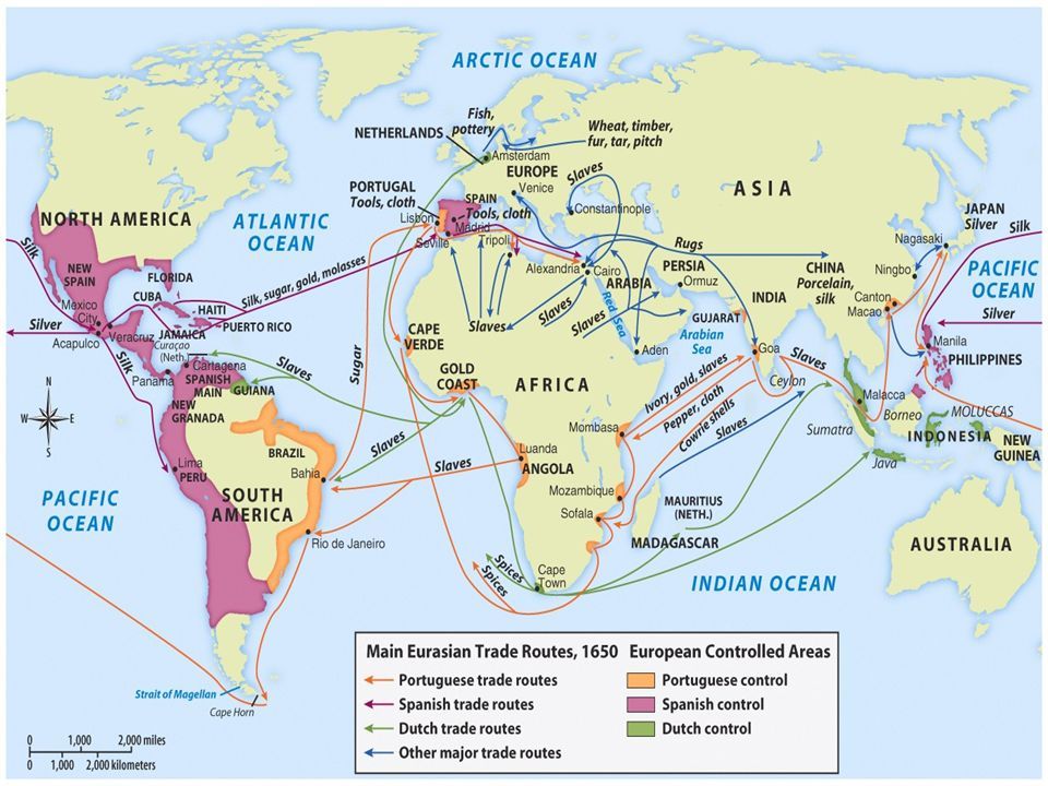
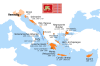
Main Eurasian trade routes, c.1650 - European Controlled Areas.
Source: America’s History, Sixth Edition, © 2008 Bedford/St.Martin’s
(Source: reddit.com)
Related Posts

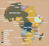
![German colonies in Africa, 1903.
[[MORE]]From the days of the German colonial empire, these maps show Togoland (later Togo), German South-West Africa (later Namibia), German Cameroon (later Cameroon) and German East Africa (later Tanzania).
Most...](https://64.media.tumblr.com/0f149d0d661bab1f7ddc1b6714a0ebfa/tumblr_nljvuqdGwk1rasnq9o1_100.jpg)

Main Eurasian trade routes, c.1650 - European Controlled Areas.
Source: America’s History, Sixth Edition, © 2008 Bedford/St.Martin’s
(Source: reddit.com)
 karlos71 liked this
  tekgrif75 liked this
  untitledjuan liked this
  jewishowl reblogged this from mapsontheweb jewishowl liked this orchidseo reblogged this from mapsontheweb
  tritiated reblogged this from mapsontheweb
  32232232 liked this halo6000 liked this flamingmacaw liked this