A Smart City Is an Accessible City
A new breed of accessibility apps can make life easier for people with disabilities. They can also make it harder.
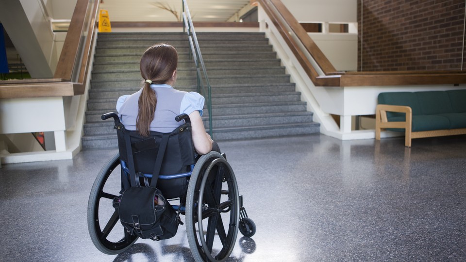
A group gathers on a Nashville street corner, some rolling in wheelchairs and others walking. They have arrived holding their smartphones and make friendly chatter while a coordinator helps them log in to an app. Dispersing in small groups, they examine restaurants, cafes, and shops, looking for features signaling that disability is welcome there: a parking sign with the International Symbol of Access, a wheelchair ramp, an automatic front door, a wide bathroom stall with grab bars, braille text, low-flicker lighting, glare-free floors, scent-free soap. The groups use the app to document and rate these features. Once submitted, the information accumulates in a database that others can use to find accessible locations.
The event is an accessibility “map-a-thon,” an effort to document features of the built environment through collective labor, and turn data collection and visualization into tools for disability activism. They take advantage of smart-city technologies, particularly geolocated databases of business listings, to share information that may otherwise be available through only word of mouth. A combination of Google Maps and what some users refer to as “disability Yelp,” such apps are helping improve information and access. But even as they make some things better, digital-accessibility maps are only as good as the data they contain. Bad ones risk making urban life harder, rather than easier, for disabled people.
Digital-accessibility maps are proliferating rapidly, thanks in part to the release of apps such as AXS Map, Access Earth, AccessNow, and Wheelmap. In the decade that I have been studying accessibility, I have come across dozens of these projects (and even started one of my own). Some, such as AccessNow and AXS Map, are carried out by and with their potential users: people who are disabled and who identify a gap in more mainstream mapping technologies. Others are supported by people with relationships to disability, such as family members or therapists, and still others by philanthropic start-ups and major technology companies, such as Google.
Digital-accessibility maps assume that crowdsourcing serves two purposes. First, user-contributed data can provide information quickly while simultaneously educating the public about accessibility best practices. Some apps even allow users to establish profiles and receive recognition on leaderboards for the number of places they have surveyed. Some hope that this will spur the emergence of a new type of urban citizenship: the so-called smart citizen, a technologically enabled community member who contributes time, labor, and device time to generate data about everyday life. Even if such a citizen does not identify as disabled, noticing and documenting the built environment can promote awareness of barriers that many people with physical, sensory, and mental disabilities face.
People have been crowdsourcing accessibility data far longer than apps have been around. Disability activists have been drawing maps by hand for decades to prove the need for curb cuts, wheelchair ramps, signage, and other features that make public access possible, particularly for wheelchair users. In cities such as Berkeley, California, and Urbana and Champaign, Illinois, environmental audits, mapmaking, ad-hoc design practices, and “guerrilla urbanism” have enabled wheelchair and power-chair users to get around otherwise inaccessible cities by, for example, fashioning curb cuts from found materials.
But long before crowdsourcing became a term for technology-assisted outsourcing, disability activists were questioning the wisdom of the crowds in this process. Many disability activists are fond of the motto “Nothing about us without us,” which binds together design practice and political protest. Consequently, many of these interventions have taken place outside formal architecture or urban-planning practices. That cuts both ways. In Berkeley, people who are blind or visually impaired sometimes objected to guerrilla urbanist curb cuts, arguing that such interventions made cities less predictable and therefore harder to navigate. Eventually, activists worked in cross-disability coalitions to produce a new design standard: a curb cut with raised, yellow, tactile bumps that would enable wheelchair access while also signaling the coming change in grade to someone using a cane.
Like guerrilla urbanism, accessibility mapping is often a collective, political endeavor: a way of staking a claim for better access to public spaces as a group effort. That may sound obvious, but the enforcement of laws such as the Americans With Disabilities Act is often conducted to resolve individual grievances, not to create infrastructure for all. If I encounter an inaccessible place, it is up to me to bring forward a complaint, which may launch an investigation, at the conclusion of which one business may be required to make changes to its physical environment. If I want to make the building next door more accessible, I have to go through the same process.
The result is a patchwork of accessible and inaccessible locations. New urban trends promoting more stairs and LED lighting (which can cause migraines and sensory overstimulation), and smart-city campaigns designed without considering visual impairments, create additional obstacles. Accessibility mapping becomes an ongoing project, not a onetime effort.
One solution is accessibility map-a-thons, which have taken place around the world, from Nashville to Paris. Getting lots of people together can produce broad, collective understandings of access and can help people who do not typically experience access barriers to notice and report them. Assembling that data into databases surfaced by apps makes that information enduring.
But despite their good intentions, map-a-thons sometimes presume a binary kind of accessibility, or that anyone can notice and measure the built environment’s accessibility. Many simply ask whether a location is accessible: yes or no. Others look for wheelchair access alone, ignoring nonmobility disabilities related to sight, hearing, cognition, chronic illness, learning, or chemical sensitivity. In most cases, data report on only a business’s entryway, when the minimum requirements of the Americans With Disabilities Act Accessibility Guidelines require far more detailed measures of accessibility.
People who primarily move by walking might not be aware of the spatial parameters needed for a wheelchair to turn inside a small space, like a bathroom. People who rely on vision to navigate might not know how to assess a location for its friendliness to the visually impaired. People who are not sensitive to certain lighting or scents might not even notice the presence of these features. Crowdsourcing can create as many problems as it solves.
An app might mark a bathroom as “accessible” if stairs need not be negotiated to reach it. But the height of hand dryers and sinks might make it inaccessible, even for the wheelchair users who initially inspired the observation. The quality of lighting or the presence of chemical cleaners could make that same space inaccessible for different people, too. Likewise, information about whether staff are fluent in American Sign Language, whether menus and signs appear in braille, or whether flickering lights could cause seizures often goes overlooked in the data sourced for digital-accessibility apps. Evaluating these features relies largely on lived experience—thus that disability-rights motto, “Nothing about us without us.”
“Nothing about us without us” also extends to the design of broader urban and digital infrastructures. Many digital-accessibility apps reinforce current trends in inaccessible smart-city technologies. According to Smart Cities for All, a project of the accessible-technology experts Victor Pineda and James Thurston, smart-city technologies promise to “seamlessly integrate” citizens’ daily lives with urban spaces by “connecting our personal devices with city services upon which we rely.”
But 60 percent of experts report that people with disabilities are left behind by these new urban technologies. Some cities, including New York and Dallas, have designed “smart screens” with accommodations, such as headphone jacks and audio descriptions for people who are hard of hearing and high-contrast modes for people with visual disabilities. But most smartphone accessibility apps do not include these features. Instead, their data are primarily visual and textual, creating potential barriers for users who are visually impaired or have sensory-processing disabilities.
For digital-accessibility maps to work, they need to be designed by cross-disability coalitions, similar to the ones that developed the tactile-pavement curb cut. Rather than relying entirely on visual representations of data, for example, digital-accessibility apps could expand access by incorporating “deep mapping,” or collecting and surfacing information in multiple sensory formats. Such a map would be able to show images of the doorway or integrate turn-by-turn navigation. Deeper digital-accessibility maps can offer both audio and visual descriptions of spatial coordinates, real-time information about maintenance or temporary barriers, street views, and even video recordings. These capabilities are not yet present in most digital-accessibility apps, partly because they build upon digital-mapping tools that assume that a view of streets and storefronts is sufficient.
That’s changing, slowly. In 2017, Google Maps started to allow users to add information about wheelchair access to business listings in six major cities. Once expanded, the availability of such data could supplant other digital-accessibility maps entirely, absorbing listings into a global technology in much the same way that other disability-supportive technologies have been marketed toward mainstream consumers. This development could result in a more usable repository of accessibility information, eliminating redundancy across mapping platforms. But of course, it also risks institutionalizing the preconception that access means wheelchair access, baking it into a popular, global tool such as Google Maps.
Global technologies raise other concerns. There are cultural and geographic differences among accessibility standards. U.S. guidelines, while adopted or modeled in some countries, do not address the realities of disability in others. A study of toilet accessibility in India, for example, found that standards for wheelchair-accessible restrooms are not helpful in contexts where a person crawls or uses a different kind of mobility device (such as a skateboard or a cart), or where squatting toilets are more prevalent. The global popularity of Google Maps, combined with default English-language data, may give the impression that accessibility belongs to people with disabilities in Western, English-speaking countries alone.
But even if all these problems were solved, digital-accessibility apps still pose one final threat to disability advocacy in urban environments. Apps can make cities more navigable, but they do not change the material features of that environment. Most of the time, they record the current conditions in the built environment rather than advocate for better ones. Before apps came on the scene, disability activists used mapping to catalog injustices and to imagine alternative futures: new environments in which accessibility was the norm, rather than the exception. Contemporary projects should incorporate that lesson, too. By incorporating knowledge from broad groups of people with disabilities, digital mapping could do more than just record the world as it is today. It could also drive political, design, and policy improvements. After all, to deserve the name, a smart city ought to be a better city, not just a more technological one.