The Library of Congress Is Putting Its Map Collection on the Map
A new partnership with the Digital Public Library of America will put three major LOC map collections online

Map lovers rejoice: soon, thousands of maps from the Library of Congress’ collection will be free to gaze at online. Thanks to a new partnership with the Digital Public Library of America, about 5,000 rare and historic maps will soon be easily accessible in a news digital catalogue, Allison Meier reports for Hyperallergic.
Recently, the Library of Congress (LOC) signed a memorandum of understanding stating that the world’s largest library will start sharing parts of its digital collection with the Digital Public Library of America (DPLA). As part of an effort to make these documents easily available from a central location, the LOC will begin by uploading 5,000 maps from three collections covering the Revolutionary War, the Civil War, and panoramic maps, Meier reports.
“We are pleased to make the Digital Public Library of America a new door through which the public can access the digital riches of the Library of Congress,” Librarian of Congress Carla Hayden says in a statement. “We will be sharing some beautiful, one-of-a-kind historic maps that I think people will really love. They are available online and I hope even more people discover them through DPLA.”
While many of these maps are currently available through the LOC’s website, this agreement will help make more digitized public materials accessible from the same place instead of forcing map-lovers and researchers to cast a large net across the internet. Now, the LOC is joining thousands of other collections and libraries, including the Smithsonian Institution and the Internet Archive, in putting together a massive digital collection of books, maps, and historical documents, Meier reports.
“The Library of Congress’s extraordinary resources will be exponentially more available to everyone in the United States through DPLA. This partnership will benefit everyone, from curious thinkers to scholars,” Amy Ryan, President of the DPLA’s Board of Directors, says in a statement.
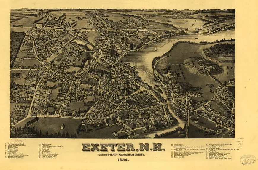
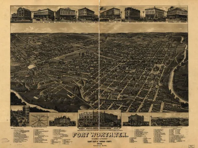
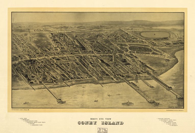
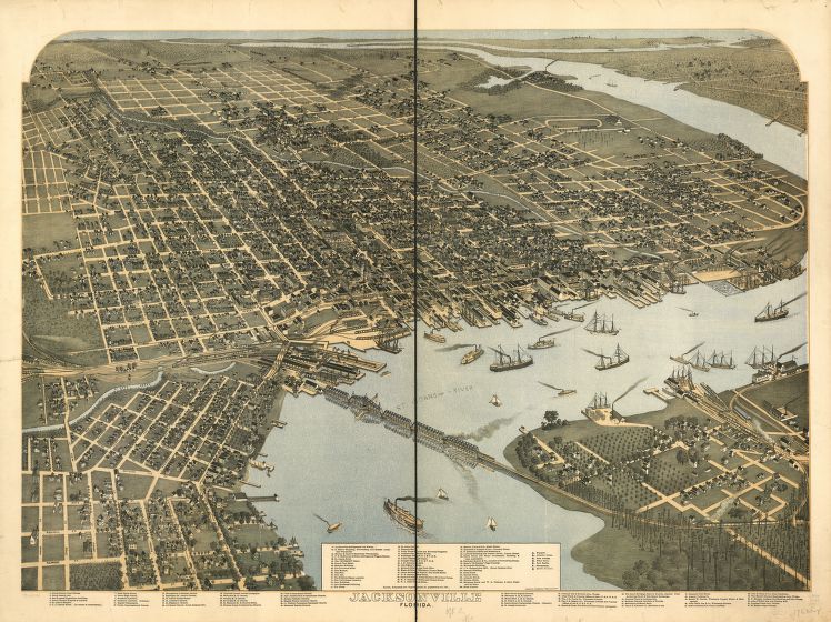
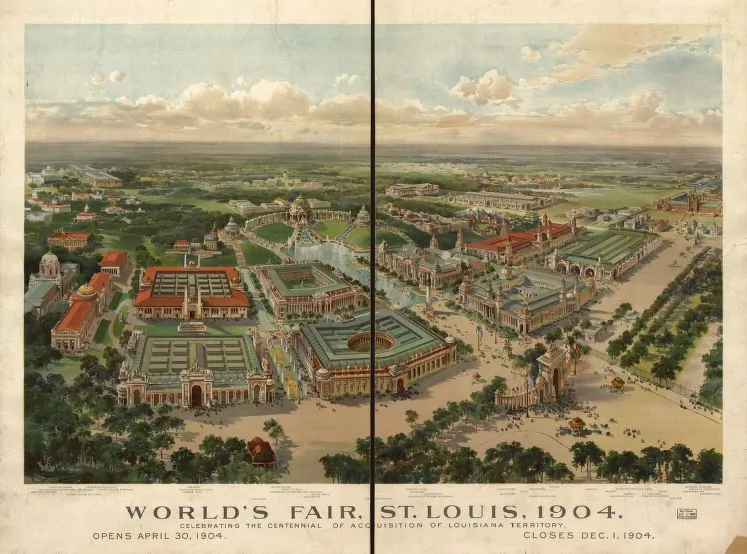
The first batch of maps the LOC is uploading include historic maps dating back to the Revolutionary War and the Civil War, but its collection of panoramic maps are perhaps the most intriguing and technically stunning. Long before the global positioning system and Google Maps helped people get around, the only way to make large-scale maps of the country’s thriving cities was to walk the streets, Kelsey Campbell-Dollaghan reported for Gizmodo. After completing seriously detailed surveys of their subjects, these mapmakers would etch every little detail their could fit into their panoramic maps, with the end result being sprawling, majestic looks at the U.S.’s rapidly growing cities.
As historians John R. Hébert and Patrick E. Dempsey write in an essay for the LOC’s collection:
Panoramic maps graphically depict the vibrant life of a city. Harbors are shown choked with ships, often to the extent of constituting hazards to navigation. Trains speed along railroad tracks, at times on the same roadbed with locomotives and cars headed in the opposite direction. People and horsedrawn carriages fill the streets, and smoke belches from the stacks of industrial plants.
Now, thanks to this new agreement, many more people will soon have easy access to these beautiful and priceless historical artifacts.