
In this video tutorial you will learn step by step how to code your first web map in Leaflet


Coding web maps becomes one of the key skills to land a good job in the geo industry. With the large variety of different libraries and APIs it’s actually much easier than you might think. We’ve partnered with Kuba Konczyk – author of awesome online webinars on web maps coding and we’re bringing to you a series of entry level tutorials so that you will finally develop new skills in that area.
This is a second tutorial of the series. The first one was a high level introduction to web development. This time you will go one step further and build your first web mapping application step by step.
https://youtu.be/j_ko6umXeJ8
Here you’ll find all the extra materials needed for the class.

#GeoDev
Next article

Geographer James Cheshire and designer Oliver Uberti have recently published an amazing book called Where the Animals Go. It is composed of 50 maps that shows a secret life of wild animals captured with GPS trackers, satellites, camera traps, drones, and other tools. The data were gathered from scientists from all around the world and beautifully mapped.
Here are a couple of examples:
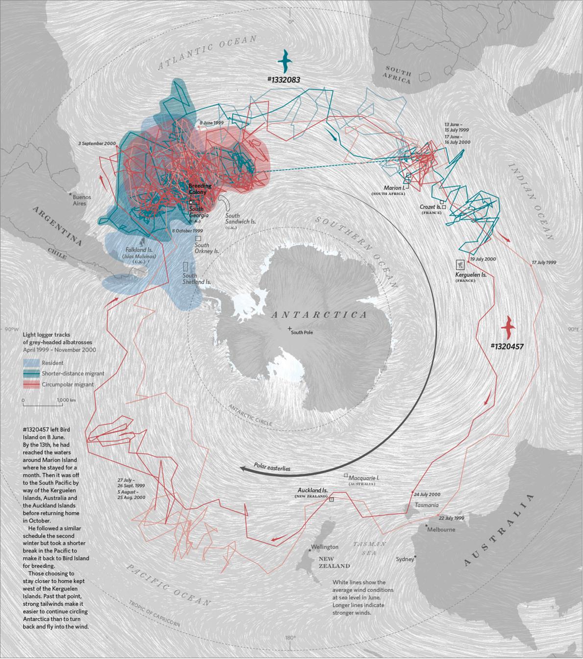
The map below shows tracking data from grey-headed albatrosses that reveal how some birds stay home while others follow the winds to make a 25,000-kilometer migration around Antarctica.
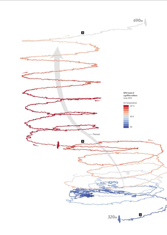
Another map show the vertical movement of birds. Many of them use updrafts to get to higher altitudes in their search for food.
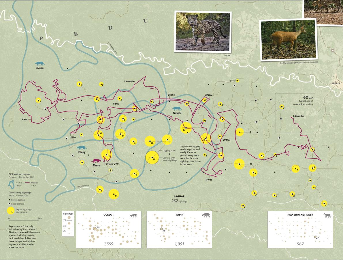
This map reveals the spatial behaviour of jaguars in Peru mapped with GPS trackers and camera traps.
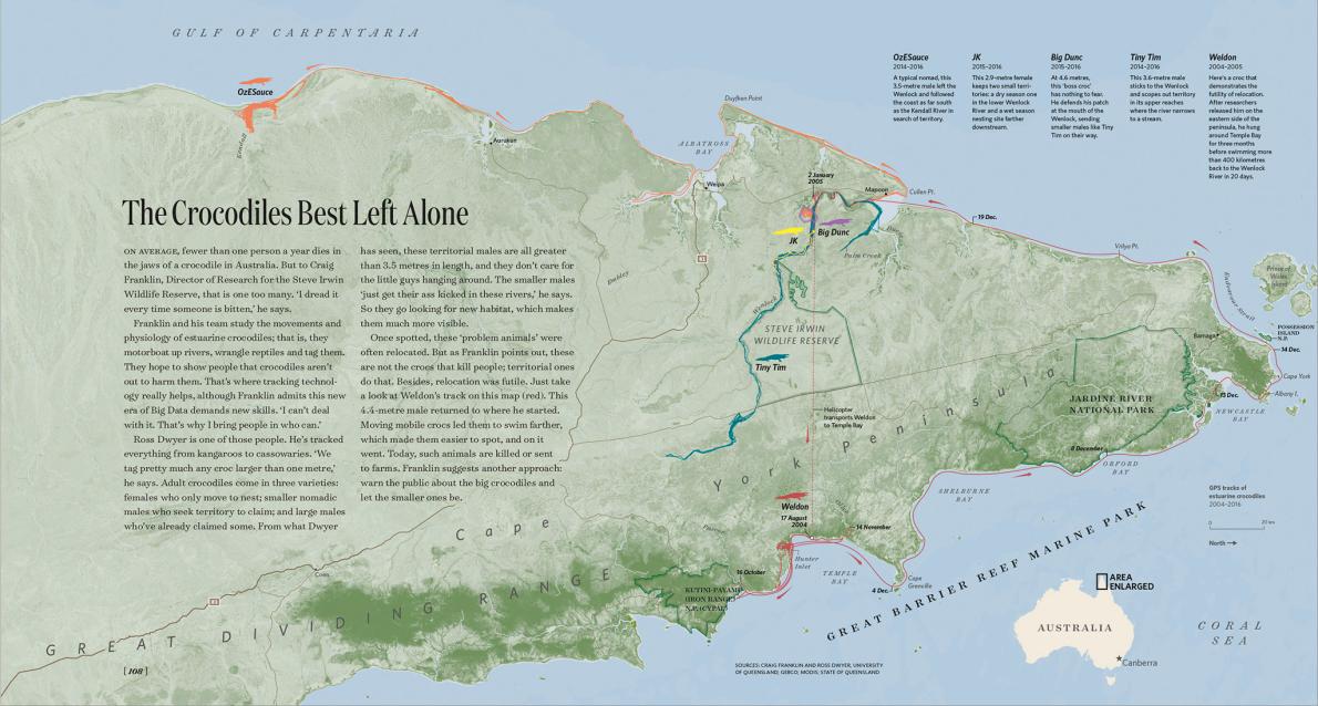
Another map shows how Australian crocodiles, relocated from human habitats have soon found their way back to the same location.
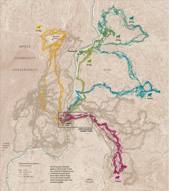
Last but not least a map based on a study of baboons living along the Ewaso Ng’iro River in Kenya that shows how groups of the animals decide when it’s time to move.
Amazing project!!!