


‘Nina’ enters PAR, seen to make landfall on Christmas Day
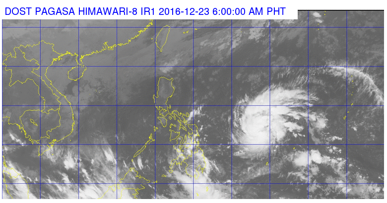
This satellite image from Pagasa shows the location of severe tropical storm Nina (Nock-Ten) as of 6 a.m. on Friday.
Severe tropical storm Nina (international name: Nock-Ten) entered the Philippine area of responsibility early Friday, the state weather bureau said.
The storm, last located 960 kilometers east of Guian, Eastern Samar, will bring moderate to heavy rains within its 350-kilometer diameter, the Philippine Atmospheric, Geophysical and Astronomical Services and Administration (Pagasa) said.
Nina packed maximum sustained winds of sustained winds of up to 95 kilometers per hour (kph) near the center and gusts of up to 120 kph.
The storm was earlier predicted to make landfall over Samar-Bicol area on Christmas Day.
The northeast monsoon, meanwhile, continued to affect northern Luzon
Cloudy skies with light to moderate rainshowers and thunderstorms will be experienced over Eastern Visayas, Caraga and Davao Region, Pagasa said.
Partly cloudy to cloudy skies with isolated light rains is expected over the regions of Ilocos, Cordillera and Cagayan Valley.
Metro Manila and the rest of the country will have partly cloudy to cloudy skies with isolated rainshowers or thunderstorms. IDL
RELATED STORIES
‘Nina’ to enter PAR Thursday or Friday; trip cancellations imminent
Expect ‘Nina’ for Noche Buena, Pagasa warns


